Convention Boundary of British Honduras
Convention Boundary of British Honduras
Convention Boundary of British Honduras
The 1859 Convention Boundary of British Honduras [also known as the 1859 Convention or Wyke-Aycinena Treaty].
The Convention between Her Majesty and the Republic of Guatemala relative to the boundaries of British Honduras, signed on the 30th April, 1859.
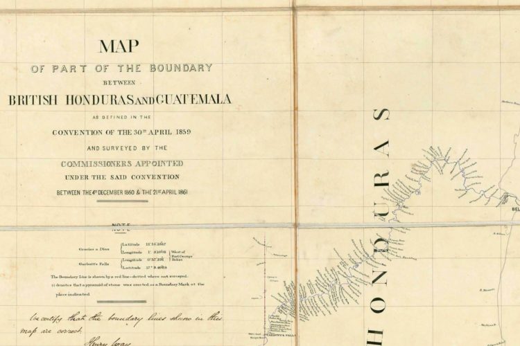
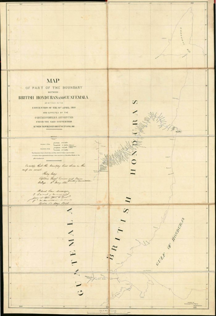
In 1861, a map was produced showing part of the boundary between British Honduras and Guatemala as defined in the 1859 Convention surveyed between 4 December 1860 and 21 April 1861.
Reference: FO 93/39/3, The UK National Archives
Description: Convention. Boundary of British Honduras [also known as the Wyke-Aycinena Treaty]. Includes Map of part of the Boundary between British Honduras and Guatemala, as defined in the Convention of the 30th April 1859, Map of part of the boundary between British Honduras and Guatemala as defined in the Convention of 30 April 1859 and surveyed between 4 December 1860 and 21 April 1861 by the Commissioners appointed under the said Convention. Scale: 1 inch to 6 miles. Drawn by V G Clayton, Lt RE. Map annexed 13 May, 1861)
Date: 1859 Apr. 30
Held by: The National Archives, Kew
Legal status: Public Record(s)
Download: Organization of American States PDF